 Miya Bholat
Sep 10, 2026
6 Geofence Rules That Reduce Bad Fleet Alerts
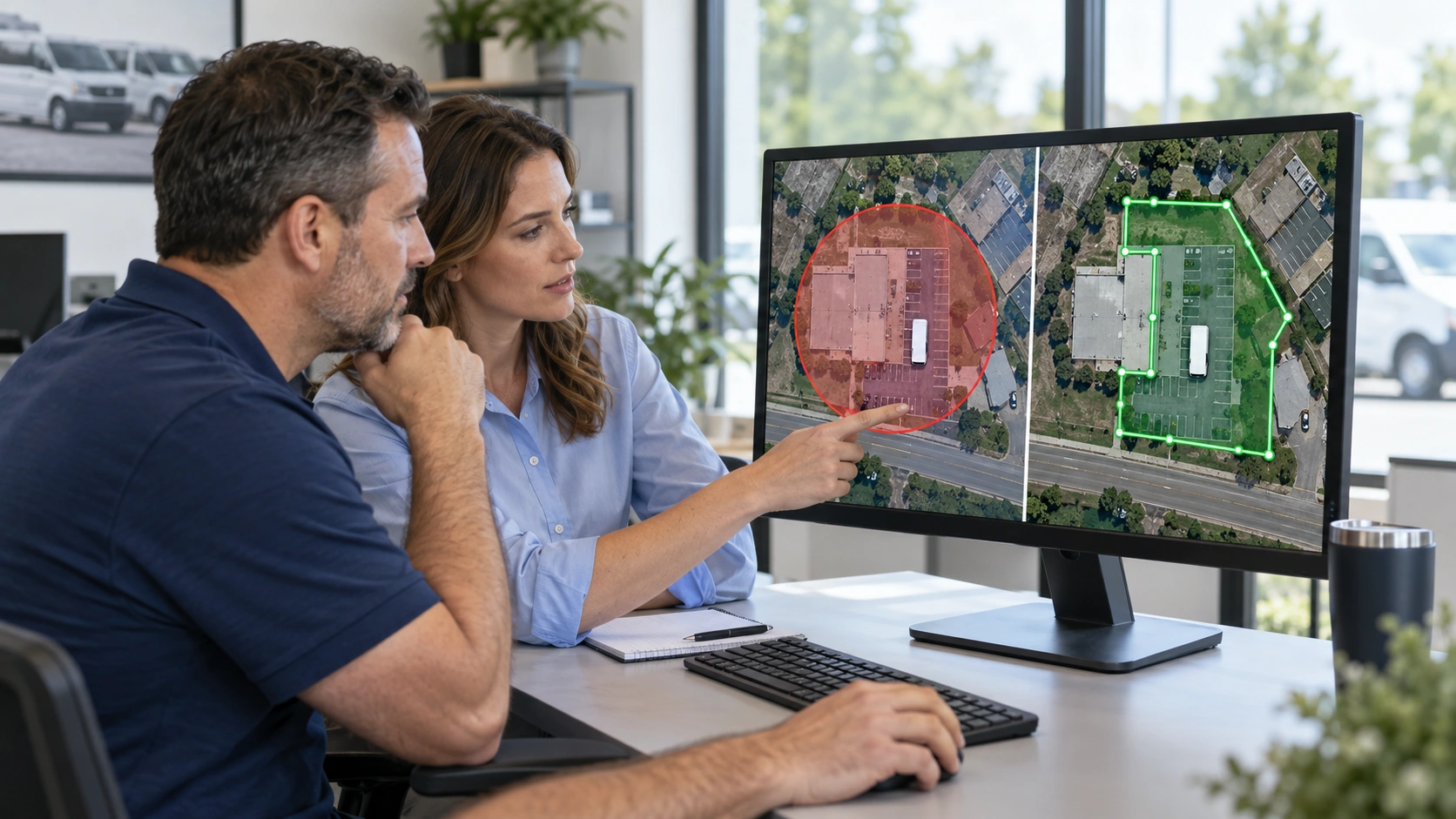
Most bad geofence alerts are a configuration problem, not a software problem. The solution is to tune every zone around real GPS accuracy, site layout, operating hours, vehicle behavior, and the person expected to act on the alert. A strong GPS fleet tracking and telematics setup gives fleets the location data to make those decisions. These six rules turn a flood of routine movements into a smaller set of alerts that deserve attention.
They build on the operating practices behind fleet geofencing, with a focus on reducing noise after zones are already live. For construction operations, this becomes especially important because trucks, trailers, equipment, deliveries, and contractors can share a changing site boundary.
Key Takeaways
- Match every boundary to real GPS accuracy. Give each zone enough buffer to account for normal location drift and site conditions.
- Use polygons when a circle includes unrelated space. Custom boundaries prevent nearby roads, lots, and customer properties from triggering alerts.
- Require dwell time before an event fires. A confirmed stop carries more value than a single GPS point near a boundary.
- Apply time and day conditions. Routine daytime movement should not create the same alert as after hours activity.
- Split entry and exit logic. Arrival, departure, and unauthorized movement require different rules and responses.
- Route alerts by zone purpose. Send security, maintenance, and dispatch events to the role that can act on them.
Why "Bad" Geofence Alerts Are a Setup Problem, Not a Software Problem
Fleets often blame the platform when alerts become noisy, but the usual cause is a default setting that was never adjusted for a real location. A tight boundary around a busy site, an alert that runs all day, or a rule with no defined owner will create notifications nobody trusts. Reasons fleet tracking alerts get ignored explains the wider alert fatigue issue. The geofence specific solution is to configure each zone around a defined operational decision.
Rule 1: Size Every Boundary to Match Real GPS Accuracy
Do not trace a geofence directly along a property line, gate, loading bay, or building wall. Official U.S. government GPS performance data reports better than 2.2 meter horizontal accuracy 95 percent of the time in open sky. That performance is reliable, but it does not mean every point will land exactly where the vehicle sits.
Accuracy can degrade substantially near tall buildings, dense tree cover, enclosed yards, and large metal structures. Signal reflection can produce 10 meters or more of error in some obstructed environments. That is why one fleet wide radius fails across different site types.
Start with this practical formula:
Minimum boundary buffer = expected GPS drift + safety margin
For an open depot, a 10 meter drift allowance plus a 10 meter safety margin creates a 20 meter starting buffer. Increase it where the site has trees, tall structures, or a public road close to the property edge. Fleet GPS tracking data becomes more useful when supervisors test these settings against real arrivals and departures instead of accepting a default radius.
Before finalizing a zone, check these sources of drift:
- Tree cover around a yard or customer site
- Tall buildings beside access roads
- Vehicles parked near metal structures
- Narrow spaces between buildings
- Roads that run alongside the site
Rule 2: Use Polygon Shapes Where Circles Create Noise
Circles are fast to create, but they can include space that has nothing to do with the actual location. A circular boundary around a narrow job site may capture public roads, adjacent properties, or a shared parking lot. That creates false entry and exit events even when a vehicle never reaches the intended destination.
When a Simple Circle Still Works
A simple circle works well for isolated depots, rural yards, single building sites, and lots with clear separation from nearby traffic. Use it when a reasonable buffer still stays within the location you want to monitor.
When a Polygon Is the Only Fix
Use a polygon when the zone has an irregular shape or sits directly beside other activity. It takes longer to create, but it removes alert volume that your team would otherwise have to review.
Polygons are usually the better choice for:
- Dense delivery zones
- Shared parking lots
- Adjacent customer sites
- Long or irregular job sites
- Properties beside public roads
Vehicle location quality also depends on the reporting hardware. GPS tracking devices for fleet vehicles should report consistently before you spend time correcting what may be a device placement issue.
Rule 3: Require Dwell Time Before an Event Fires
A single GPS point crossing a boundary does not always prove that a vehicle arrived, stopped, or performed work. It may only reflect normal location jitter near the edge of the zone. Dwell time filters that noise by requiring the vehicle to remain inside for a meaningful period before the alert fires.
Set dwell time according to the event you want to confirm. A job site arrival may need three to five minutes. A delivery stop may need five to ten minutes. An after hours security zone may need a longer period so a vehicle passing near the perimeter does not create an unnecessary escalation.
This setting also makes real time fleet tracking and monitoring easier to interpret because the event represents a verified presence, not an isolated location point.
Rule 4: Add Time-of-Day and Day-of-Week Conditions
A depot entry at the start of a normal shift is useful operational context, but it is not a security issue. The same movement at midnight on a weekend may need immediate attention. Time conditions let the same boundary support both normal operations and exception reporting without creating alerts for every routine movement.
Use time conditioned zones where activity is expected only during defined windows. Good candidates include:
- After hours depot exits
- Weekend storage yard activity
- School zone restrictions during pickup and drop off periods
- Customer sites with scheduled service windows
- Job sites with contractor curfews
Match schedules to actual department hours. A single weekday rule will not suit fleets with night shifts, emergency work, or rotating maintenance crews.
Rule 5: Split Entry and Exit Logic Instead of One Blanket Rule
A general boundary crossed rule treats a routine morning departure the same way as a theft risk exit. That creates irrelevant alerts because entry and exit mean different things depending on the zone.
Create separate logic for each direction. Shop entry can confirm that maintenance received a vehicle. Shop exit can notify dispatch when work is complete, or notify security when movement occurs outside approved hours. Entry at a customer site can confirm a scheduled arrival, while exit can flag an unexpectedly short visit.
Accurate logic also requires accurate asset records. Fleet data models for vehicles, drivers, and GPS help prevent a geofence event from being associated with the wrong vehicle or driver.
For many zone types, splitting entry and exit rules can remove roughly half of irrelevant notifications because routine arrivals no longer share the same workflow as security sensitive departures.
Rule 6: Route Each Alert by Geofence Purpose, Not to One Inbox
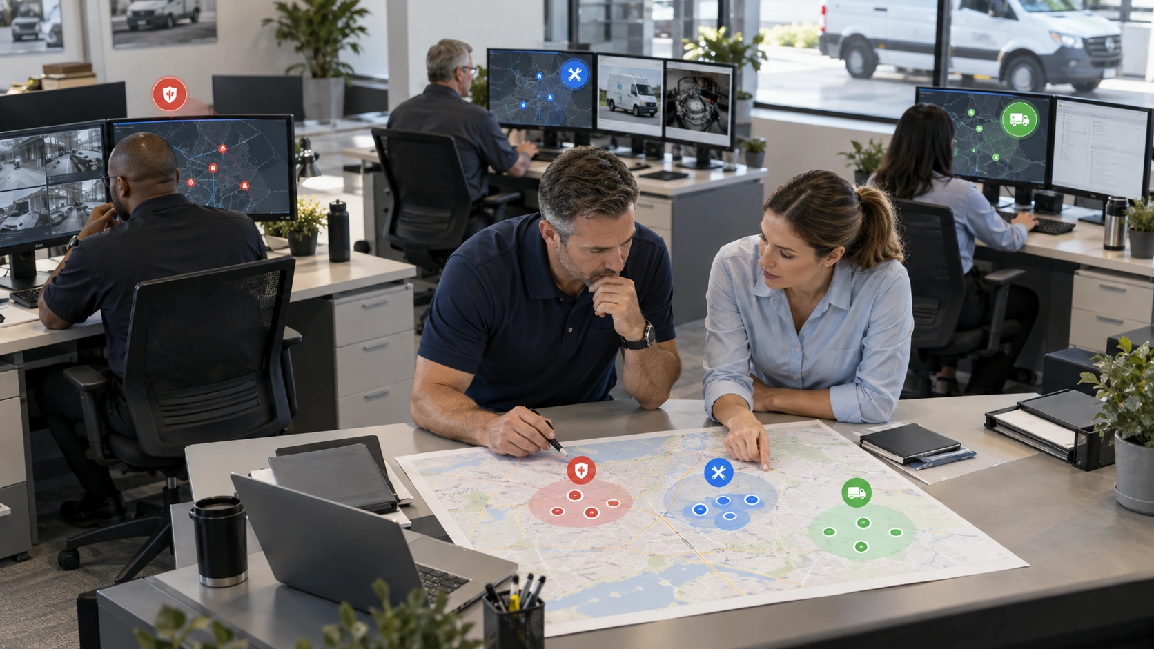
A security alert, a maintenance arrival, and a dispatch update should not all go to one shared inbox. Each event should reach the role that has the authority and context to act.
A 2026 fleet technology survey of nearly 900 fleet professionals shows that GPS and telematics adoption is now widespread. The advantage no longer comes simply from collecting location data. It comes from deciding which events matter and who owns the next step.
Use this routing structure:
- Security or dispatch receives after hours movement alerts
- Maintenance receives shop arrival and departure confirmations
- Dispatch receives job site arrival, departure, and missed location events
- Operations leadership receives only escalated exceptions
Alert routing by role provides the broader framework for keeping notifications actionable. For geofences, the rule is simple: each event needs one owner and a defined response.
How to Audit and Prune Geofence Rules Every Quarter
A quarterly review prevents outdated boundaries and unused alerts from becoming permanent noise.

Start with event volume, review the operational purpose of every zone, and document each approved change. Fleet reports and dashboards can help teams compare event volume before and after they revise a rule.
- Pull geofence event volume by zone, event type, and recipient.
- Identify zones producing the most alerts with no required response.
- Check for overlapping zones that cover the same road, driveway, or property.
- Retest each boundary against actual approach roads and parking patterns.
- Confirm that dwell time and time conditions still match current operations.
- Remove or merge zones that have no defined purpose or owner.
- Document the shape, conditions, recipients, and reason for every change.
Six Geofence Rules at a Glance
| Rule | What It Fixes | Quick Setting |
|---|---|---|
| Match boundary size to GPS accuracy | False events near site edges | Add expected drift plus a safety margin |
| Use polygons for complex sites | Alerts from roads and neighboring properties | Trace the usable site footprint |
| Require dwell time | Single point GPS jitter | Use three to ten minutes for normal stops |
| Add time conditions | Routine movement reported as an exception | Limit security rules to off hours |
| Split entry from exit logic | Routine arrivals mixed with risk events | Build separate rules by direction |
| Route by purpose | One inbox overloaded with unrelated alerts | Assign one accountable role per event |
Fleets with mixed vehicle types gain more from zone by zone tuning than from one fleet wide default. A team managing trucks, service vans, trailers, and equipment can set distinct expectations for each site and movement type. AUTOsist GPS and telematics software supports the location visibility needed to configure, monitor, and refine these rules over time.
Frequently Asked Questions
-
How do I know whether a site needs a circle or a polygon geofence?
Use a circle for an isolated depot, rural yard, or single building where a reasonable buffer does not reach unrelated space. Use a polygon when the circle would include a public road, shared parking lot, neighboring property, or irregular job site footprint. -
How big should a geofence buffer be?
Start with expected GPS drift plus a safety margin. An open site may work with about 20 meters, while sites near tall buildings, tree cover, metal structures, or busy roads often need a larger buffer. Test the zone with actual vehicle arrivals before relying on its alerts. -
Why does a geofence alert fire when the vehicle never entered the site?
GPS points can shift near a boundary because of signal reflection or obstruction. This happens more often beside buildings, under tree cover, and in dense areas. A buffer, polygon boundary, or dwell time requirement can stop a single inaccurate point from creating an event. -
What dwell time should a fleet use for a geofence alert?
Set dwell time based on the decision the event supports. Three to five minutes often confirms a job site arrival. Five to ten minutes can work for customer or delivery stops. Use longer thresholds for after hours security zones where a brief pass near the edge should not create an escalation. -
Who should receive geofence alerts, and how often should rules be reviewed?
Send each event to the role that can act on it. Maintenance should receive shop arrival events, dispatch should receive operational exceptions, and security should receive unauthorized after hours movement. Review all geofence rules at least quarterly, and sooner after site, schedule, or ownership changes.